


M62 Junction 32A: Ferrybridge: the North and Wetherby
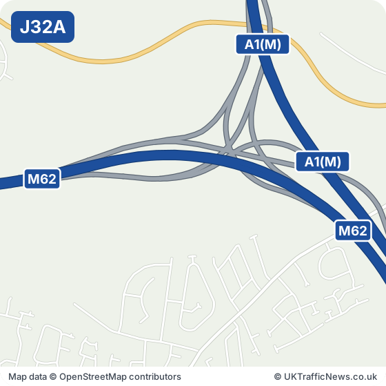
M62 J32A: Holmfield Interchange is where the M62 meets the A1(M). Like the junctions near Swinton on the M60, it looks like a pile of spaghetti on a plate (though not the official Spaghetti Junction, which is on the M6 in Birmingham): curving roads blending into each other, with no roundabouts or rings to drive around. The M62 and A1(M) also meet at the next junction, J33.
Point of interest: the Ferrybridge power stations. North-east of the junction stood Ferrybridge's power stations for nearly a century. The first, Ferrybridge A, opened in 1927. The coal-fired Ferrybridge C, one of the biggest in the country at about 2,000 megawatts, first connected to the grid in 1966, and its eight huge cooling towers were a landmark beside the motorway. In November 1965, before the station was even finished, three of the eight towers collapsed in 85 mph winds; they were rebuilt by 1968. It stopped generating in March 2016, and its cooling towers came down between 2019 and 2022. Two smaller plants that generate power from waste, Ferrybridge Multifuel 1 and 2, now work on part of the site.
Pontefract is about a mile and a half south-west, and Ferrybridge and Airedale are also beside the junction. Pontefract Monkhill station is about a mile south-west, Moto Ferrybridge Services about a mile and a half south-east, and RSPB Fairburn Ings about two and a half miles north-west. Castleford Interchange (J32) is about a mile and a half west; Ferrybridge Interchange (J33) about a mile and a half south-east.
Check this junction now: live M62 speed flow map · latest M62 traffic news · M62 trends
Collisions near junction 32A: the police recorded 2 injury collisions on the M62 within about 2.5 km of this junction in 2024 and 2025 (1 serious, 1 slight); 1 on a wet or icy surface; 2 in darkness. These are the police-reported figures published by the Department for Transport (STATS19).
For the A1(M), see live A1(M) traffic.
- Junction M62 J32A
- Signed for A1(M) · Ferrybridge: the North and Wetherby
- Next junction eastbound J33, 0.9 miles
- Next junction westbound J32, 0.9 miles
Live traffic at M62 junction 32A
The speed strip below shows the M62 from junction 31 to junction 34, both directions, from National Highways’ live data, checked every five minutes.
Live traffic speed flow: M62 Junctions 31 to 34
Untick all three to see just the speeds. We show the important overhead signs and the mandatory speed limits (red ring); see every overhead sign.
Go to our live M62 traffic speed flow map ›
NOTE: The speed flow, overhead sign messages or other information shown on our live traffic speed flow map is updated every few minutes. We cross check the data and aim to provide warnings if there could be a delay or an inaccurate speed reading. There can be occasions, beyond our control, and despite our best efforts where the speed flow could be inaccurate. We cannot therefore guarantee the speed you can expect on any stretch of the motorway is always accurately shown. However we hope you will find our live traffic speed flow map a useful tool in trying to plan your journey. Safe driving.
All the latest M62 traffic news →Live M62 traffic flow map →
Around M62 Junction 32A: Towns and Places on the Map
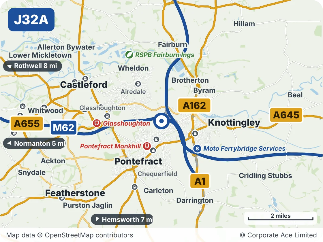
| Place | What it is | From the junction |
|---|---|---|
| Pontefract Monkhill | Railway station | About 1 mile south-west |
| Moto Ferrybridge Services | Motorway services | About 1.5 miles south-east |
| Glasshoughton | Railway station | About 2 miles west |
| RSPB Fairburn Ings | Park or nature reserve | About 2.5 miles north-west |
Junctions either side
Live traffic news at M62 Junction 32A
Incidents and roadworks between Junction 31 and Junction 33 that we are aware of.
M62 eastbound Jct 32 exit slip lane 2 closure
23:46 (11:46pm)21 Oct 2026reported 20 min ago
- Location
- M62 J32 eastbound exit
- Direction
- Eastbound
- Lanes closed
- Slip road closed
- Reason
- Other
- Schedule
- 21:00 (9pm) Wed 21 Oct 2026 → 05:00 (5am) Thu 22 Oct 2026
+ 5 more near Junction 32A - see all the M62 traffic news →
This is the news for Junction 32A only, not the whole M62. For the rest of the motorway see all the latest M62 traffic news, the overhead signs and the speed limits in force now.
Updated 00:07 (12:07am) Thu 22 Oct 2026